



Description
Product Overview
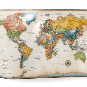
The Rand McNally Atlas is a compact, hardcover reference book designed for on‑the‑go exploration and study. Measuring 9 × 4.25 inches and weighing just 2.82 ounces, it combines portability with comprehensive cartographic detail. Printed on high‑quality paper, the atlas features vibrant colors, clear labeling, and a durable binding that resists wear. Published on May 3, 2024, it includes the latest geopolitical boundaries and topographic information, making it a reliable resource for both casual users and serious scholars.
Usage
This atlas is ideal for a variety of settings. Students can use it for geography homework, teachers can reference it during lessons, and travelers can plan routes before a trip. Its slim profile fits easily into backpacks, briefcases, or even a coat pocket, allowing quick access during flights, road trips, or field studies. Homeowners often display it on a wall as an educational piece that doubles as décor, while professionals in logistics and planning appreciate its up‑to‑date data for route optimization.

Why Choose Us
Rand McNally has a legacy of over a century in cartography, ensuring each map reflects meticulous research and precision. The atlas benefits from rigorous quality control, guaranteeing color fidelity and accurate scale across all pages. Unlike generic maps, this edition offers a blend of modern digital updates and classic print durability, providing a trustworthy tool that endures frequent handling. Customer reviews average 4.8 out of 5 stars, highlighting satisfaction with detail, portability, and build quality.
Key Features
- Compact 9 × 4.25 inches size for easy transport and storage
- Lightweight 2.82 oz construction without sacrificing durability
- High‑resolution color maps with up‑to‑date political boundaries
- Sturdy hardcover binding designed for frequent use
- Ranked #46 in Atlases and #76 in Wall Maps on major retailer platforms
FAQ
What regions are covered in the atlas?
The atlas includes global coverage, featuring continents, countries, major cities, and key physical features such as rivers and mountain ranges.
Is the atlas suitable for classroom use?
Yes, its clear labeling and durable format make it an excellent teaching aid for geography lessons and student projects.
Can I use the atlas for detailed trip planning?
Absolutely. The detailed road networks, city layouts, and topographic information support comprehensive travel itineraries.
How often is the content updated?
The current edition reflects data accurate as of its 2024 publication date, incorporating recent geopolitical changes.
Does the atlas include a legend or index?
Each section begins with a legend explaining symbols, and an alphabetical index at the back helps locate specific locations quickly.


 Ballantine Books Kindle eBook Television Production Comedy
  Rowman Littlefield Television Production Screenwriting Book
  CQNET State Quarters Collection Map Book Plastic Full Color
  Hamlyn Drama Television Production Reference Book English
  Swiftmaps World Wall Map Poster Paper Rolled
  Dey Street Books Television Production Kindle eBook
  BenBella Books Television Direction Production Biographies
  Insight Editions TV Production Book Kindle Edition Features
  Television Production Guide Kindle English Enhanced
  Cutting Edge Television Production Reference Kindle Book
  Doctor Who Handbook Television Guide Production Kindle Book
  Rand McNally Wall Maps English Edition
  Rand McNally Atlas Wall Map 9x4 Inches Lightweight
  Easy Cloud 12V 2‑Pin Fan 1800RPM Dual Ball Bearing Plastic Pack of 2
  Television Direction Production Kindle Book English Language
  Film Financing Guide Wunderfunkmaschine Kindle Book Series
  Antler Productions Television Direction Production Humor
Reviews
There are no reviews yet.